
Story so far
In my previous posts I told about Rendezvous with RAMU, simulated space mission, which ended with emergency landing at Jack. F. Paulus Skiway at Amundsen-Scott Antarctic Station.
It was not a failure of a mission, following terms of simulation, but by sense we left very expensive DeltaGlider spaceplane at Antarctica. So, now we faced a need of its recovery. Following the logic, it was possible to deliver it on sledges from Amundsen-Scott to McMurdo Station, from where it was possible to ship it by sea.
But this looked too long. So, remembered USSR cargo plane VM-T “Atlant”, and US plane Shuttle Carrier Aircraft I decided to recover DeltaGlider by air. This looked like new, interesting simulation, useful for navigation training.
Goals of simulation
- Improve air navigation skills, including expertise in
- basic navigation
- astronavigation
- radio navigation
- flight by INS
- Test celestial navigation and course plotting algoritms developed during Circumpolar flight simulation
Cargomaster
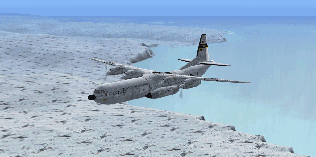
As a vehicle for the mission we chose Douglas C-133 Cargomaster. It looked weird enough to looks cool, match required parameters, used for rocket transportation in real life, and had nice model for MSFS 2004. Also it was easy to modify it for simulation purposes. For educational purposes I made number of improvements (same I did with P-47), including:
- changes in simulated avionics
- changes in simulated aircraft systems (engines, electric system, fuel storage system)
- installation of additional equipment (simulated INS, drift measurement equipment, celestial navigation system, weather radar, backup GPS, etc.)
- changes in flight model (to represent weight, drag and lift balance changes after addition of internal extra fuel tank and DeltaGlider attached “on the shoulders”)
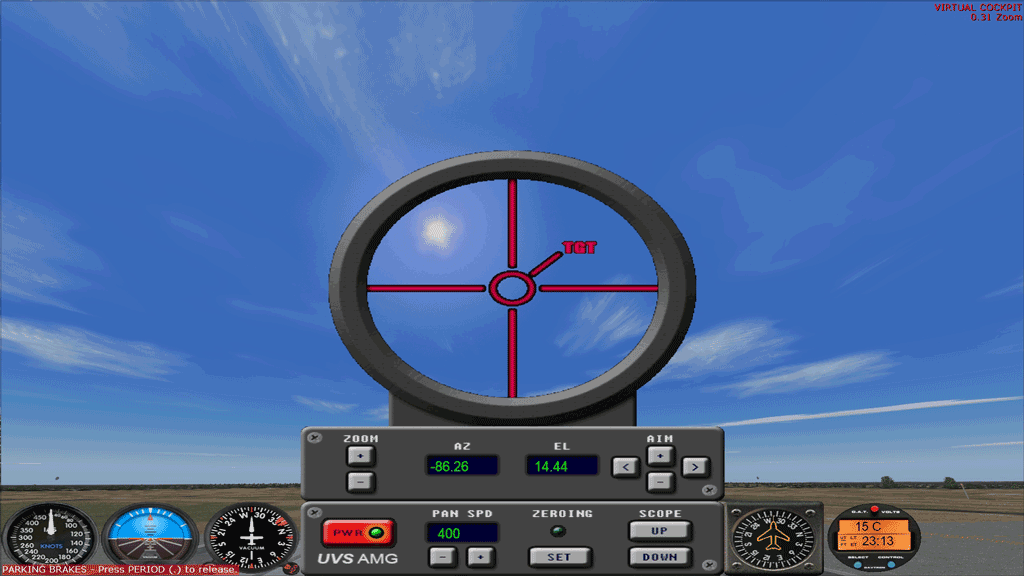
Additionally, for simulation purposes I had to develop celestial navigation system add-on, allowed to measure elevations of celestial bodies in simulator with enough precision.
Flight
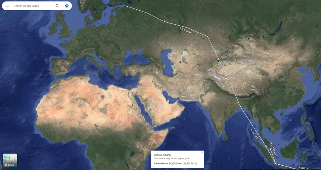
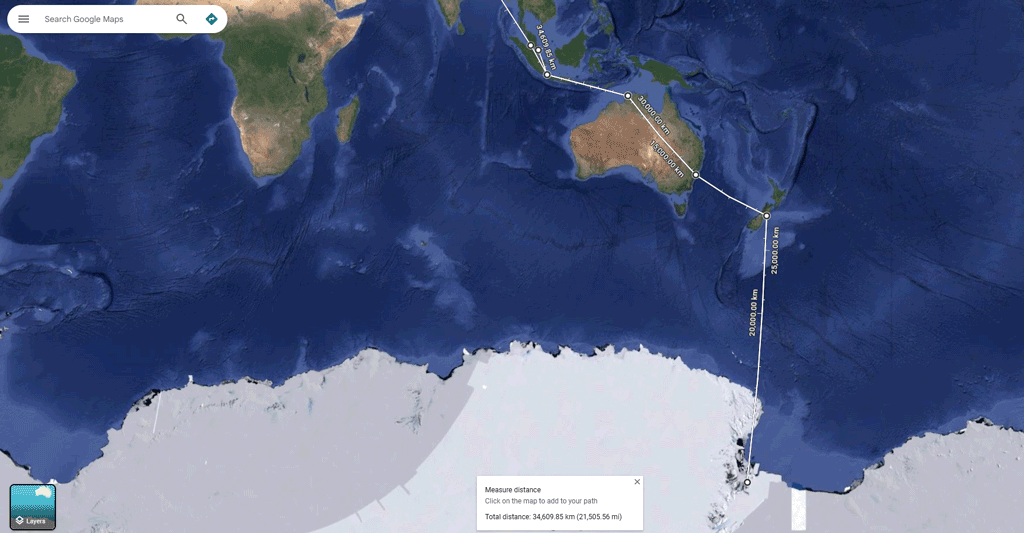
In October-November 2023 I with my friends Anna Apalkova and Rebecca W. Lee performed a simulation of a long-range recovery flight by the route St.Petersburg – Kazan – Astana – Almaty – Kolkata – Kuala Lumpur – Jakarta – Darwin – Sydney – Christchurch – McMurdo Station – Christchurch – Sydney – Darwin – Jakarta – Singapore.
Despite number of tough circumstances, mission was finished successful.
Results
Typically I provide a report about simulated mission, but about this mission I will publish no report – it had not been written because circumstances (in life, job, etc.) did not allow me to do this.
In a nutshell, during this simulation I:
- Heavily re-worked my celestial navigation software library
- Greatly improved my knowledge about structure of flight simulation architecture
- Improved my knowledge about long range air navigation, including celestial navigation
- Got solid experience of work on simulated INS
Key insight
Notice, that in Results section I put work on my navigation software library at first place.
That was by a reason. During this simulation I faced troubles with compatibility between Python modules and Python versions on different platforms. If to explain shortly, my Python-based celestial/aerial navigation software suite I launched on Android through Termux totally declined to work after 2 years passed since circumpolar flight simulation. The trouble was caused because of zero compatibility of Python modules on Termux with modules for desktop systems.
Searching for solutions and understanding the misery of modern software was greater impression and more valuable insight from this simulation, than navigation experience itself.